Search here
 Log In
China Pakistan Economic Corridor
‘If ‘One Belt, One Road’ is like a symphony involving and benefiting every country, then construction of the China-Pakistan Economic Corridor is the sweet melody of the symphony’s first movement.’
Wang Yi, China’s Foreign Minister
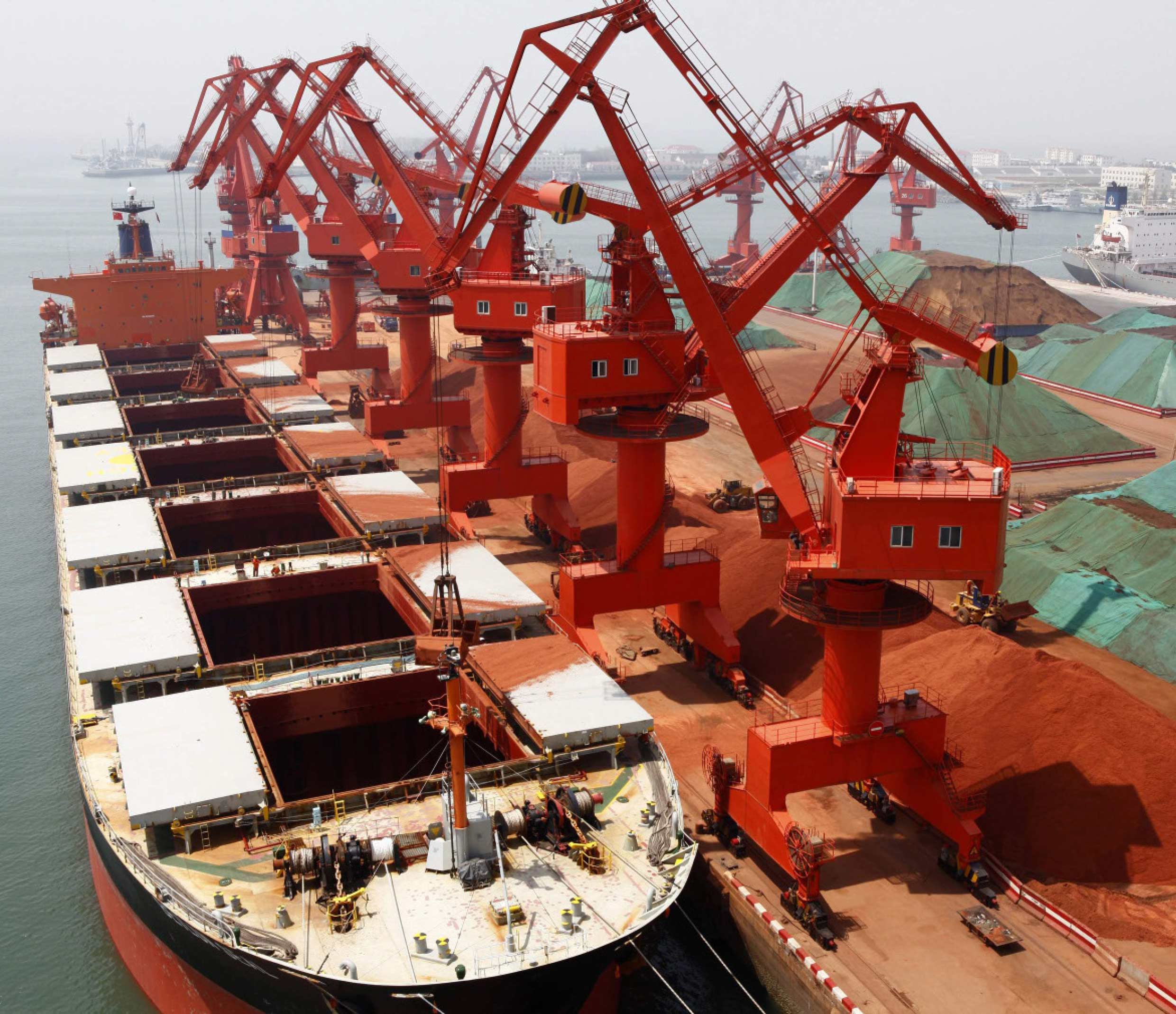
China sees a historic opportunity to redraw the geopolitical map by building critical infrastructure that could kick-start economic growth and open new trade routes between China and Central and South Asia. A cornerstone of the project will be to develop the Pakistani port of Gwadar, a warm-water port run by the Chinese on the doorstep of the Middle East.
The largest part of the project would provide electricity to energy-starved Pakistan, based mostly on building new coal-fired power plants. The plans envision adding 10,400 megawatts of electricity at a cost of $15.5 billion by 2018. After 2018, adding a further 6,600 megawatts is outlined—at a cost of an additional $18.3 billion—that in cumulative total would double Pakistan’s current electricity output.
Gwadar, operated by a state-run Chinese firm, is set to begin commercial operations this year, and one of the deals to be signed by the Chinese president while in Pakistan is a final agreement on building a new international airport there.
China sees Pakistan as a strategic counterweight to India. Northwest China is far from the Chinese coast, and shipping goods to and from there through Pakistan would potentially be quicker and cheaper than using any Chinese port, cutting costs and time in half. China is concerned that too much of its trade depends on the narrow sea channel of the Strait of Malacca. In the event of a future war in Asia, the Strait of Malacca could be blockaded by the U.S. Navy or another competing power. Pakistan would provide an alternative land route for Chinese trade.
However, both China and Pakistan do not have the comfort of time. As part of its long-term planning, China has framed three corridor routes to overcome a greater security challenge in the South China Sea in shape of possible blockade of Sea Lane of Communications at the point of Straits of Malacca during conflict times. Any blockade may stop 80% of Chinese imported energy supplies from the Middle East and West Africa. It also wants to develop western surrounding areas by heavily investing in these regions.
China had three options to make its connectivity better and economical as well in terms of time and cost.
CPEC is the most appropriate gateway for China to get connected with Arabian Sea. The southern corridor begins from Guangzhou, which is the third largest city of China in South Central China. This route moves towards western parts of China and connects Kashgar with Pakistan at Kunjarab – a point from where China wants to link to Gwadar port in the Arabian Sea. It is the shortest and the most feasible option for China.
The second (2nd) Chinese option is the Central Corridor that starts from Shanghai and links the country to Tashkent, Tehran and onwards to Bandar Imam Khomeini Port of Iran on the Persian Gulf. One of its branches goes up towards Europe but it was a longer route.
The third (3rd) Chinese option is the Northern Corridor that starts from Beijing, passes through Russia, and links it to European cities.
After a decade of planning, China formally launched the idea of Silk Road Economic Belt, known as the One Road, One Belt, in October 2013. In this backdrop, China and Pakistan signed a Memorandum of Understanding on China-Pakistan Economic Corridor on July 5, 2013. The CPEC, which will be constructed from 2014 to 2030, talks about integrated links to Chinese One Road, One Belt and 21st Century Maritime Silk Route. With active consultation of Chinese authorities, Pakistan has prepared a plan to construct three corridors, the western alignment, the central alignment and the eastern alignment. The last one has been picked for development in the first phase.
Article 3 of July 2013 MoU on Long Term Plan of CPEC explains the rationales behind picking the eastern corridor. “Long-Term Plan should be developed under the principle of scientific planning, steadily developing, and take the easiest the first,”
It was on China’s demand for security and early completion of the route that led to the finalisation of the eastern corridor. The western route, where the Pakhtoon and Baloch belts lie, cannot be developed at a faster pace and is riskier in terms of security. However, there is a counter argument that development would address the security concerns.
The eastern alignment will pass through Thakot-Mansehra-Islamabad-Lahore and Multan. From Multan, the route will be linked to Hyderabad through Rohri and Dadu. The Hyderabad-Karachi portion will be linked through M-9. Karachi will then be linked to Gwadar through N-10 East Bay Express Way along the coastal line.
The work on central alignment will be completed later whereas construction on some parts of Gwadar-Dera Ismail Khan via Quetta route – western alignment – has already begun.
The argument that some parts of the country are being deprived off may be true in the short-term but, in longer term all these cities will be connected to the corridor. All provincial capitals are included as nodes, the key corner stone of CPEC on which it will be constructed.
These nodes are at Peshawar, Islamabad, Lahore, Sukkar, Karachi, Gwadar and Quetta while China will be able to address its strategic concerns, development activities will help propel growth in the country and could become a source for sustainable development. CPEC-related activities involve work worth $50.6 billion, although majority of the agreements will be settled in China.